Geography and Traffic Information Processing
Traffic Sign Labelling
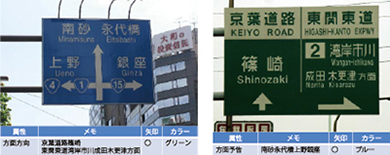
Labelling of traffic signage attributes using client-specified software.
Intersection Landmark Labelling
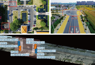
Labelling operations to determine the attributes of landmarks and the direction of travel at intersections through satellite imagery .Used for the judgement of road, obstacle and surrounding information in automatic driving to select the optimal route.
Information Labelling of Pavement Landmarks
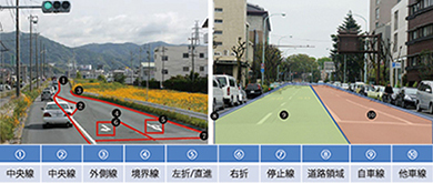
Labelling attributes such as lane dividers, road markings, self and other traffic lines.
Software
QGIS, Mapinfo, Client Specified Software
Data base
MySQL, SQL Server or Access